


Interactive USA Map Portal: Informational & Educational Resource

Select any state on the map to access real-time statistics, live weather, historical facts, and detailed dashboards for all 50 states and Washington, D.C.

    🌎 Explore US Regions
    Clickable map of the US states providing statistics, time, and weather data for major cities.
    Hover any state to preview flag, capital & population · Click to open state portal
    Highlight Region:
    US Flag
    United States
    National Overview
    50
    States
    331M
    Population
    3.8M mi²
    Total Area
    48
    Contiguous States
    💡 Did You Know?
    The US has the world's largest economy by nominal GDP.

    ★ State of the Day

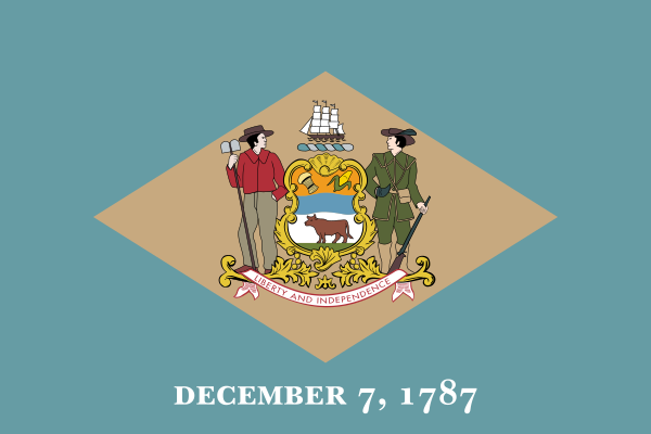
    Delaware

    The First State

    CapitalDover
    Population1.0 million
    Joined the UnionDec 7, 1787
    Admitted as1st State

    Delaware was the first state to ratify the US Constitution on December 7, 1787, earning its historic nickname.

    Explore Delaware →
    Flag of Delaware

    ⚖ Compare Two States Side-by-Side

    Pick two states to see them side by side.

    🌎 Explore States by Region

    🌎 Regional Maps Overview →

    🎮 Play & Learn

    Test Your US Geography Knowledge

    Can you name every state by shape? Match all 50 flags? Guess the capital? Try our interactive geography games and challenge yourself.

    Play Geography Games →

    📖 About the Portal

    Explore the Interactive USA Map Dashboard

    Welcome to the most intuitive interactive US map designed for rapid navigation and state-level data access. Whether you are a student, researcher, or business professional, our United States dashboard provides a visual gateway to all 50 states and the District of Columbia.

    Our tool is built for speed and ease of use. Simply click on any state within the interactive map to be instantly redirected to a dedicated state portal. Each sub-portal is optimized to provide a focused look at that specific region's geography and data.

    Key Features of Our Mapping Tool

    • Full 50-State Coverage: Access customized dashboards for every state, from the West Coast to the Atlantic.
    • Mobile-Ready Interface: Seamlessly navigate the US map on mobile or tablet devices with touch-optimized clicking.
    • Zero-Lag Navigation: Built for performance, ensuring your transition from the national map to state data is instantaneous.
    • Educational Resource: An ideal tool for learning US geography and state locations through an engaging, clickable interface.

    🧭 Regional Guide

    Navigate the United States by Region

    To help you find information faster, we have organized our state portals into four primary geographic regions.

    The Northeast

    Explore the historical and economic hubs of the Northeastern United States: Connecticut, Maine, Massachusetts, New Hampshire, Rhode Island, Vermont, New Jersey, New York, and Pennsylvania.

    The Midwest

    From the Great Lakes to the Great Plains, our Midwest state map covers Illinois, Indiana, Michigan, Ohio, Wisconsin, Iowa, Kansas, Minnesota, Missouri, Nebraska, North Dakota, and South Dakota.

    The South

    Navigate the diverse landscapes of the Southern US, including Delaware, Florida, Georgia, Maryland, North Carolina, South Carolina, Virginia, District of Columbia, West Virginia, Alabama, Kentucky, Mississippi, Tennessee, Arkansas, Louisiana, Oklahoma, and Texas.

    The West

    Discover the vast regions of the Western United States: Arizona, Colorado, Idaho, Montana, Nevada, New Mexico, Utah, Wyoming, Alaska, California, Hawaii, Oregon, and Washington.

    🏛 Authoritative Sources

    Official US Government Resources

    For more in-depth research and official documentation, explore these authoritative US government sources:

    USA.gov ↗

    The official guide to government operations, citizenship services, and national data resources.

    U.S. Census Bureau ↗

    The nation's leading source for quality data about its people, places, and national economy.

    Library of Congress ↗

    World-class digital collections, historical maps, and the extensive record of American heritage.

    National Weather Service ↗

    Primary source for real-time weather alerts, hazard observations, and regional climate data.

    National Park Service ↗

    Discover the natural wonders, historic landmarks, and national monuments in every US state.

    U.S. Geological Survey ↗

    The nation's official source for topographic maps, geology, and natural resource surveys.

    ❓ Help & Answers

    Frequently Asked Questions (FAQ)

    How do I find a specific state on the interactive map?

    Simply hover your cursor (or tap on mobile) over any region of the map. The state name, flag, capital, and population will highlight, and clicking it will take you directly to that state's dedicated data portal.

    Does this map include all 50 US states?

    Yes. Our dashboard covers all 50 states in the Union, plus a dedicated portal for Washington, D.C.

    Is the map mobile-friendly?

    Absolutely. We have optimized the interactive US map using responsive design, making it easy to click and navigate state portals on smartphones and tablets.

    Can I use this map for educational purposes?

    Yes, our tool is a free resource designed for classrooms, geography study, and professional research. We encourage educators to use the interactive US map as a visual aid for American geography lessons.